The GRAND COULEE DAM:
 After a relaxing lunch in the rest area ‘park’ next to the river and the Gehrke Windmills, we drive the few miles to the Grand Coulee Dam dropping over the hill and easing the Westy down a steep grade of 6% – 10% to the Dam Arrival Center.
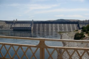
A massive 24 million cubic yards of concrete, enough to build a 4-foot-wide, 4-inch-deep sidewalk twice around the equator, it forms a lake that is 151 miles long by impounding the Columbia River. 
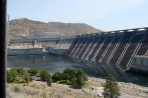
The Grand Coulee Dam is a hydroelectric gravity dam with a hydraulic height of 380 feet — more than twice that of Niagara Falls. Completed in 1941, the Grand Coulee Dam is the largestelectric power-producing facility and the largest concrete structure in the United States. It is the fifth largest producer of hydroelectricity in the world, as of the year 2008.
The dam itself doesn’t appear to be very high because of its length, but it is almost a mile across, is 1650 feet wide and 550 feet tall which is taller than the Great Pyramid at Giza. In fact ALL the pyramids at Giza could fit within the total area of the base of the Grand Coulee Dam!
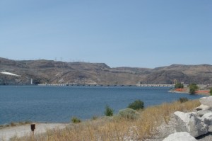
This massive reservoir, called Lake Roosevelt (officially Franklin Delano Roosevelt Lake after the president who was in office during the construction of the dam) covers 125 Square miles, stretches 150 miles from the Canadian Border to the Grand Coulee Dam, and has over 600 miles of shoreline, creating the largest lake and reservoir in Washington State.
The visitor center is an impressive educational exhibit showing the materials, methods and history of the dam, and offering fascinating and entertaining information with amazing ‘hands-on‘ displays such as a jack hammer, surveyor equipment, cut-away turbine models, different kinds of movable turbines from different dams around the country; videos of the indians who had lived in the area and were displaced by the flooding of the reservoir; short movies of different aspects of the dam.
One movie, “Fire and Water” was especially interesting to us explaining a theory of how this part of the world was formed by the ice-age floods.
First a flood of Lava that in some places is 10,000’ thick, then the glaciers flowed south and blocked the valley of the Clarks Fork River creating Lake Missoula which was 2000’ deep before it pushed the ice dam away. Lake Missoula emptied in about 48 hours, flowing at the rate of 65 mph and moving everything in its way including rocks the size of houses and depositing them miles away.
Now the rocks sit alone in the farm fields of Eastern Washington. This flood reoccurred as many as a dozen times over a few hundred years, creating the Grand Coulee and Colombia River Gorge as well as the rolling farm lands (suspected as ‘ripples’ of the receding waters)…All of this, which is what we have seen since the beginning of our trip and just driven through in the last couple of days, now makes sense. The Grand Coulee looks just like the Snake River Canyon only a bit wider.
The immense size and influence of the Columbia River and the Grand Coulee Dam is profound. Needless to say we are impressed and fascinated by this experience. Now we want to drive this trip in reverse so we can really appreciate what we have seen and driven across!


 Facebook
 Twitter